![]()
|
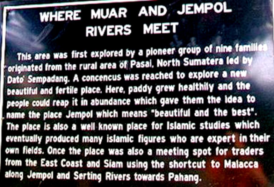
Found The East-West Trade links- Penarikan We have heard of an interesting place near Bahau where ancient traders would make their way inland from the South China Sea via the Pahang River. Then at one meeting point, all they needed was lifted their boats up, towed it overland for 600 meters. Then there would be another river that flowed downstream to the west i.e into the Straits of Malacca. Such fact is of great significant and at the same time luring to us. First, such geographical phenomenon - where 2 rivers could come so close together on the same plain. Yet ending up, with one river flowing east and the other flowing west. Couldn't resist from getting ourselves associated with this interesting fact. Next, to be able to verify its existence and the real facts and also as to how early pioneers could uncover such information. We must be on the spot. Upon arrival in Bahau, the locals we met don't seem to be aware of this ancient happening. The place appeared normal, no indication in town. To alert visitors of a place or event that worth noting. Some probing and we found the river! At last, right place - first indicator A signboard! A confluence with 2 rivers. evidence relating near to what we heard We located the first river and then on looking for the associated second river. The writing on this signboard confirms there was indeed evidences of historical past. Last line on the board mentioned traders moving east-west using the rivers. 1. Signpost with write-up
A bit disappointed with wording used. No mentioned of Muar or Sungei Muar. But reassuring that we were not on a wild goose chase. Quickly we had the pictures of our visit. Given the attitude of such low key mention, we knew the board would not be here that very long. Perhaps, the park and board was a knee jerk reaction to a report in the Some feeble attempts were made. Next, the writing did confused and missed the crucial point. The significance of the East-West travel. The landings where all these cross country runs were made possible, Otherwise the would some sort structure to signify that the jetty was here on the western point and combined with another some half kilometers away, indicating the eastern landings. No! No mention of the over land changeover! In fact to me. this small clearing here was chosen for its scenic beauty. A a site for the confluence of 2 tributaries. Perhaps, even a small board pointing "this way - Muar". For unknown reason Sungei Muar was not even mentioned. Final destination - Malacca very ambiguous. Even as I write I could feel the ambiguity question the intentions of the authority who erected such signage. The sign while trying to impart knowledge was erected in the wrong spot and conveying a different scenario. Where is the Serting River and what has this confluence got to do with the "overland" transfer? 2. Marking the focal point of Penarian
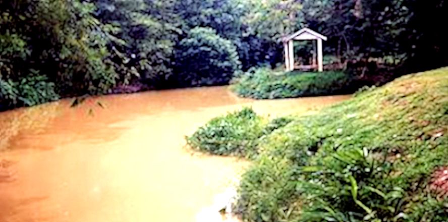
3. Start of the journy westwards Here a picture of the confluence! The speculation that early traders did indeed use this vicinity as a meeting place, but it went on to mislead that this confluence of the Muar River [left] and Jempol River [right] was the place where all it all happened!
4. A stroll in the garden To emphasize its significance - a small park was created for the local community or to highlight this historical fact. Another half baked attempt, an unnatural setting for a park.. There was with no visible access road laid out to reach this small "Garden". We passed through the compound of a water treatment plant, down a tufted slope to reach this tarred road. Just wondering how were the construction equipments brought on site! Why was that access not formalised.
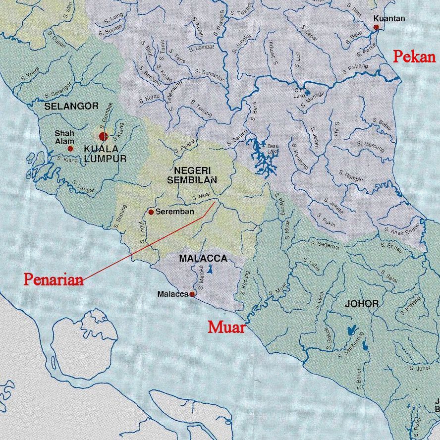
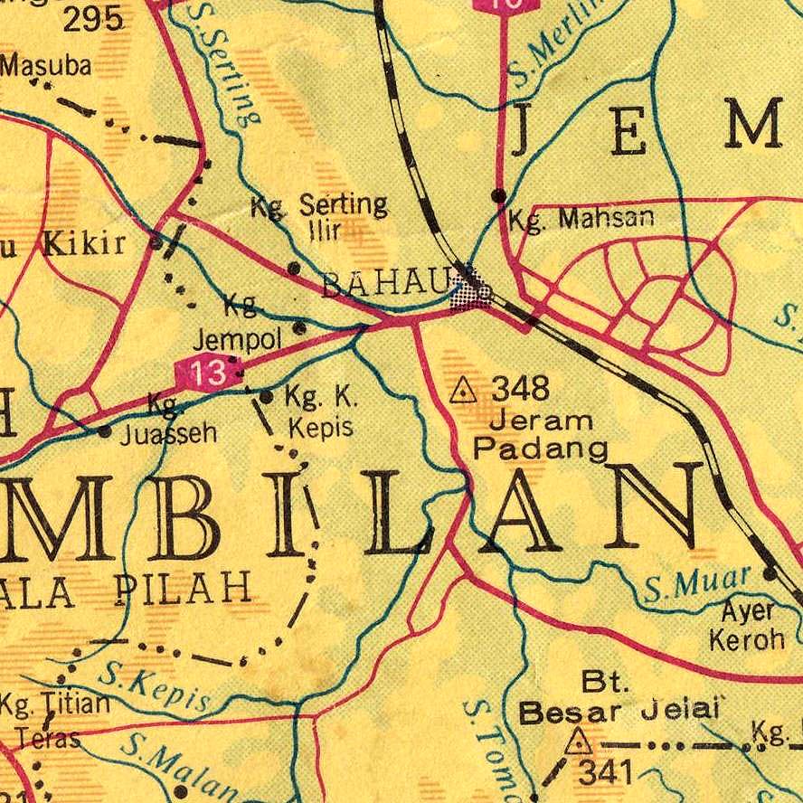
The tough upstream corridor Enough of hair pulling and negativity. For my own understanding, this physical site was created as a short cut to reach Malacca. From the 1400, Malacca was the most urbanized spot along the Strait of Malacca. Anyway for my my own interest I borrowed one most demonstrative map, putting my understanding on paper. This map below detailing how the East-West River journey could possibly had taken place. Boats made their way inland from the present day Pekan town. Sailed upstream through the huge Pahang River and then the Bera River into the Serting River. The effortless down stream cruise The Sungei Jempol or Sungei Muar is only within 0.5 kilometers away from the Sungei Serting by land . A much larger river when compared to the Serting. Very quickly, this river would be joined joined by more tributaries that empty into the large Sungei Muar ending at the estuary in Muar. This plan showed the separation of the 2 rivers and their flows east and west. an easy comparatively plain sailing downstream in either direction. 5. South China Sea - Straits of Malacca
6. My souvenir Forget about the Park and the misleading sign board. Having refreshed ourselves with the "hypothesis" above, we met a very kind Pa 'Cik. He appeared knowledgeable and had kindly showed us the few spot with remains to substantiate our understandings. He had with him records and informed us that he was the person interviewed representatives from National Museum who came to verify the "tales" Part of the route, the Sungei Jempol sigange flowing west was prominently located. The river passes the Highway, Kuala Pilah/Bahau. Here is the signage
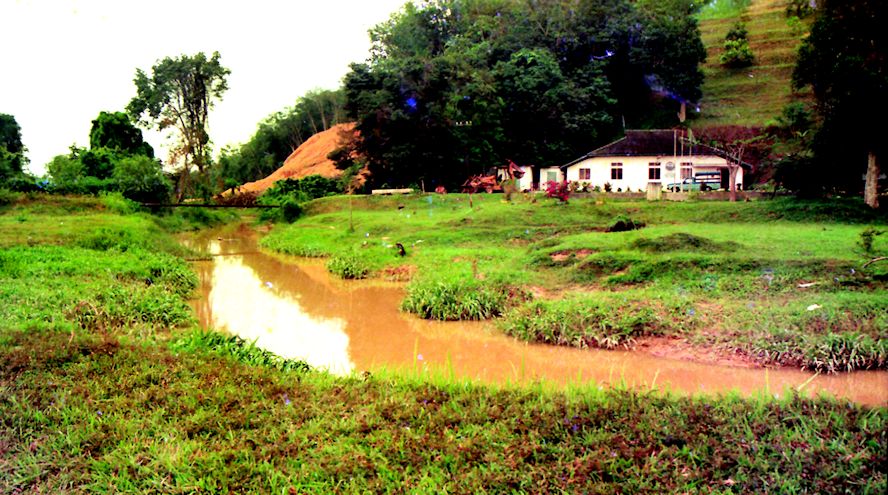
7. The Sungei Serting Of course, we did spent time on the "other" river - the Serting River. It was flowing eastwards but at that time, to me, the river was a small, silted stream. Looking at the picture, the depth of water could only support a small boat. It was flowing almost parallel to the Main Road to Bahau Town. Also gave to me the impression, we saw it was dredged.
8. Geographically speaking- how 2 rivers could have met!! We walked along its bank to follow the river upstream. We were heading towards the direction where we had earlier saw the roadside signage of Sungei Jempol. Looking for that possible nearest landing point and evidences or tell tale signs that it was last used as sort of jetty. But sadly the river bank was the back yard of a modern low cost housing estate. So worked over, distorted by residents. Chances of how it would looked like, Very slim. But we could visually detect Sungei Jempol presence. It was really that close. Both river on the same level plain! Another map now to show that meeting point in greater deatils. The scene geographically! Sungei Serting decides to hug the foothill of low hill, found its low passges between high ground and then flows eastward while Sungei Jempol found its own low ground, makes a right turn and joins Sungei Muar now flowing south easterly way! Sungei Jempol that right turn to meet up with Sungei Muar.
9. More souvenirs for the group There are so much of overwhelming coincidences. In the earlier days, settlers migrating from Sumatra had found this fertile plain - "Jempol" as the signage explains. It is important enough for the head of the group to have its presence felt. There was evidence of a palace here at this meeting point on the banks of Sungei Serting. The ground was vacant then. What is left? - an antique "Surau" was all that remains of yesteryears. With guidance's from the elderly acquaintance, we found the few graves tomb stones with Siamese inscriptions - presumably traders who had ventured so far inland! Left their marks beside and on the banks of the Jempol River. Now the housing estate is seating right on the path of this monumental "Trade Route". This place should be better known and local authorities should have seen the immense historical value, plus what a unique geographical setting! With proper installation of fixtures and signage to highlight this significant setting, school going children could be motivated to find out more about Negri Sembilan & Pahang States. This definitely help in the learning on the subjects of geography and history.. Two very important historical facts, the beginning of the 9 Negri Sembilan States. The trade routes used by early settlers.
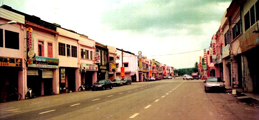
9. Bahau Town Center After the writing, name of river and pictures etc, in layman term, where is this place "Penarian" located. It is just on the outskirt of Bahau town in Negri Sembilan
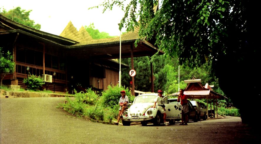
11. Jembol Rest House We were there doing another assignment on "Rest House". This is the frontage of the Jembol Rest House which by now is defunct.
This is an antique page no 41 taken out from my album "What were you doing in Y2K?". A short note, in that year 1999. it was the last year of the century, Not every one gets to live pass a millennium, more important - Do anyone realize that significance? I thought for myself. So I made it a point to create and record 52 stories, one for every week, based on the places I know in peninsula Malaysia. . Yes, so this is one of the pages. Did I succeed? Well almost. A couple of weeks I needed rest, and another couple of weeks down in Maui, Hawaii.
|